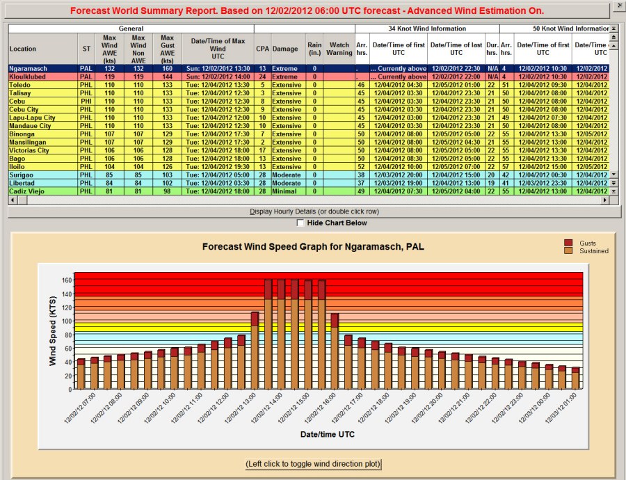
The Joint Typhoon Warning
Center (JTWC) does not
provide Wind Radii
information for storms
whose center is over land...
even if the center is
expected to move back over
open water a few hours
later. This has been a
problem for Global users who
are trying to create
forecast graphics and
reports. This year we
have significantly enhanced
the wind radii estimation to
remove this "missing data"
problem for storms in the
Western Pacific and Indian
Ocean. This will now
allow Global and Hurrtrak
Advanced users to create
consistent animations, wind
band charts and most
importantly allow for impact
reporting for both land and
sea locations.
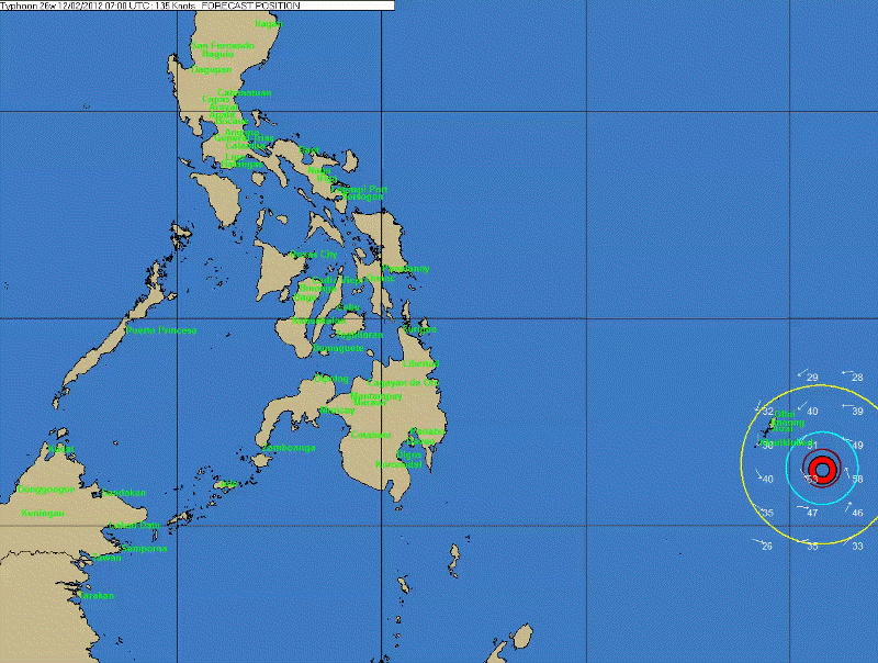
Sample animation of a storm
forecast to move across the
Philippines (Super Typhoon
Bopha, 2012)
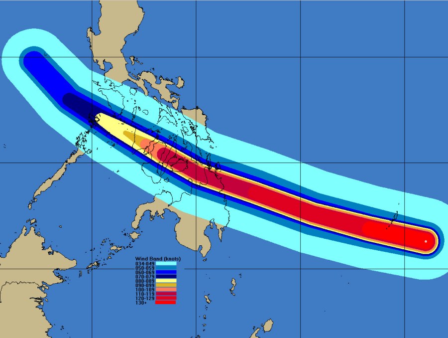
A complete Wind Band Analysis is now possible
Extensive Reporting for both inland and coastal locations