The
system now makes extensive use of astronomical tide data... which is critical
information when assessing coastal flooding potential for an approaching storm. Tide data for
“coastal” locations is included and optionally graphed on selected impact
reports. It is also described in text on the narrative impact statement. The
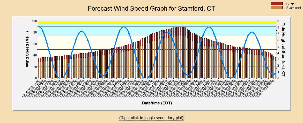
tide graph, including the tidal harmonic, is superimposed on the wind speed
graph to help determine the effects of tide heights during the period of highest
winds.
Tide harmonic superimposed on a forecast wind speed graph (click on image for high resolution)
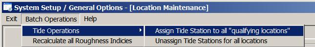
The system now has the ability to automatically associate all of your "custom"
locations with the closest "qualifying" tide station.
(The pre-defined locations already have been associated with a tide
station.)
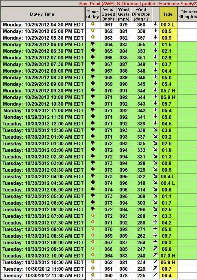
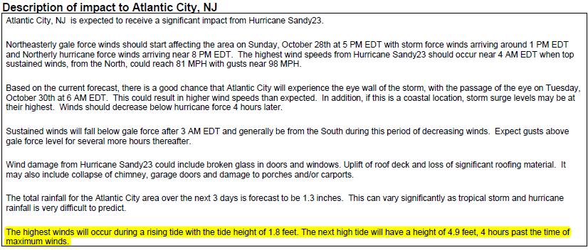
The tide information is included in the Narrative Impact Statement
As well as in a report & EXCEL format