In 2006, HURRTRAK supported the
ability to display graphic images in Google Earth (GE) . In 2007 we have taken this to
the next level by supporting export of much of the HURRTRAK data to Google Earth
via it's native KML language. This allows much greater flexibility in
viewing the storm related data along with other demographic features that are
part of Google Earth. The following series of images show some examples of this new
capability.
If you would like to view this data on your desktop version of Google
Earth, select the following link to download the KML created by the HURRTRAK
application (katrina
adv 20 sample kml.kmz). Note: V4.0 of GE is
required to view the animation.
Click on thumbnail below to view a larger animated GIF of Katrina wind radii animation in Google Earth Environment
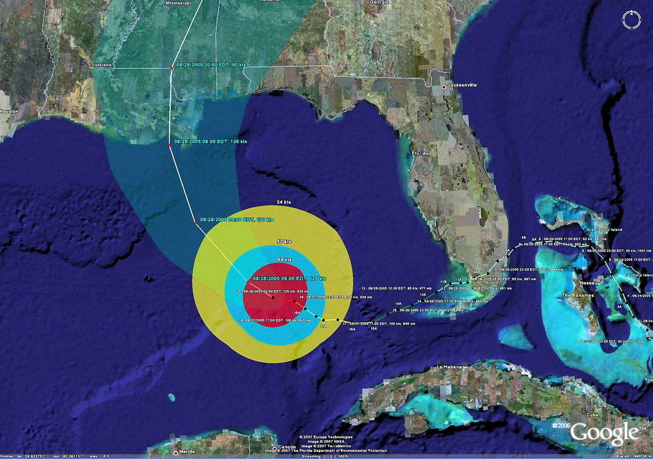
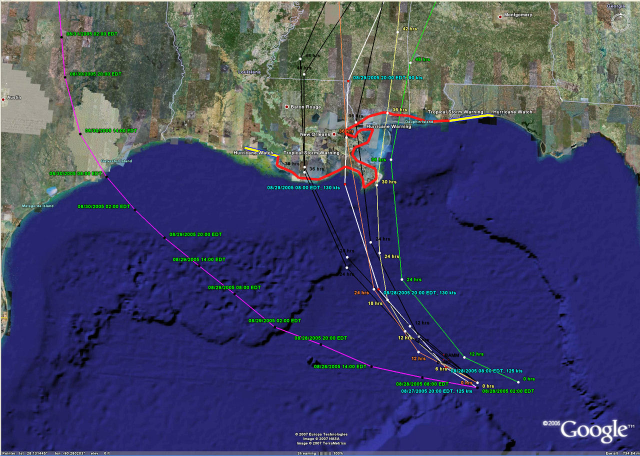
Katrina actual track, forecast track, average error and current wind radii (4 layers).
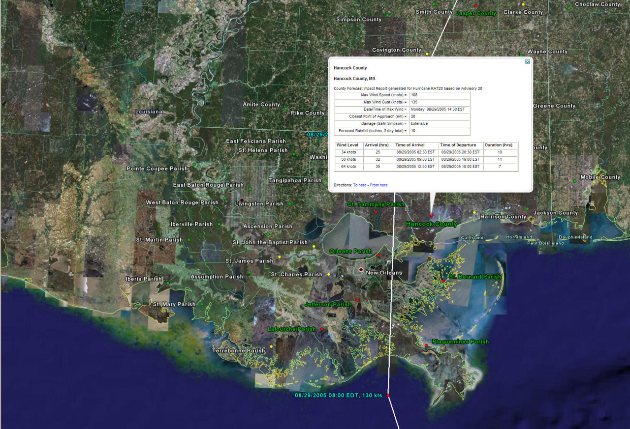
Katrina forecast track with impact report locations plotted (details show when location is selected).
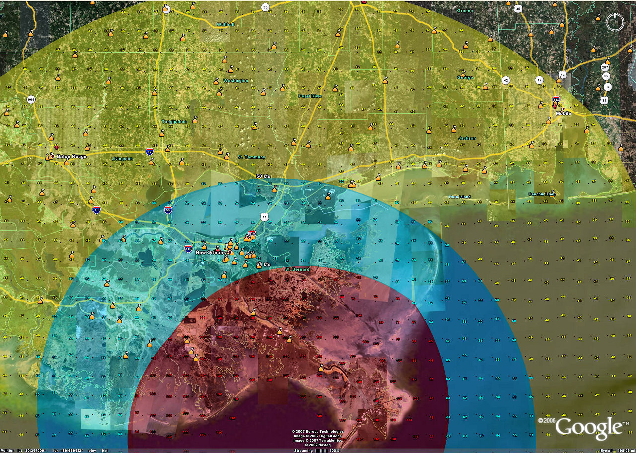
Katrina forecast wind radii, wind field (values)
and Google Earth schools layer (3 layers)
Katrina's official forecast,
forecast models, climate forecast and watches and warnings (4 layers).
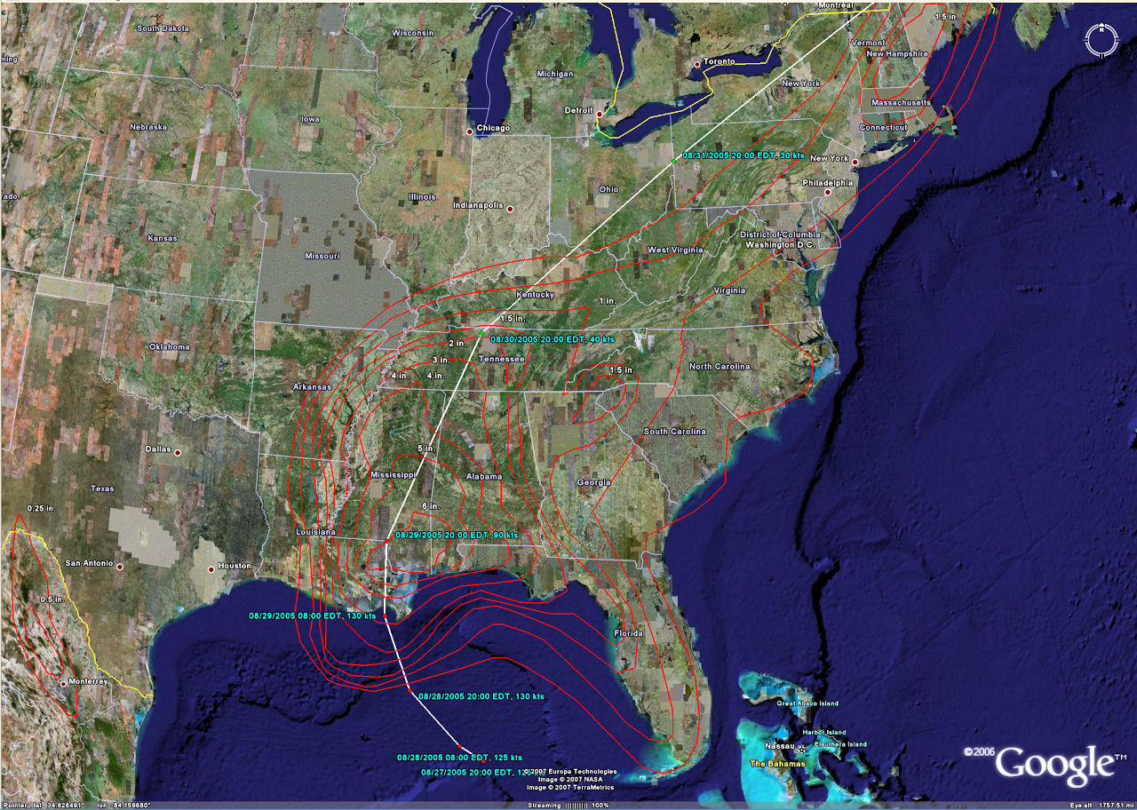
Katrina forecast track with projected rainfall (day 2)