The Atlantic Oceanographic and Meteorological Laboratory (AOML), Hurricane Research Division operates the H*Wind Project. The purpose is to devise computer programs to integrate wind data in and around a hurricane from a variety of platforms into a single wind analysis reduced to the surface. See http://www.aoml.noaa.gov/hrd/Storm_pages/surf_background.html for more information.
We have created a new (2004) program that provides an interactive method of viewing/analyzing this data.
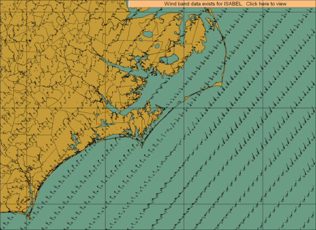
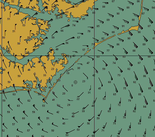
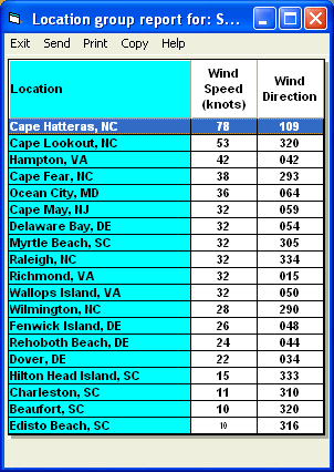
Below are some screen images of the H*Wind Display system while viewing Isabel data.
The entire wind field of the
storm.
A close up of the area around
the eye.
A report indicating the
estimated wind speeds for a set of locations. This can also be generated
for counties and zip codes.
Note: The data is made available via Hurrtrak Online as AOML makes it available. This is not operational data and is supplied by AOML on "a best can do basis" and may be delayed by several hours. See http://www.aoml.noaa.gov/hrd/Storm_pages/surf_background.html for more information.