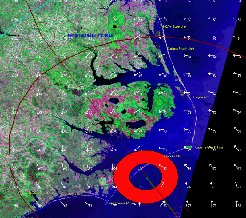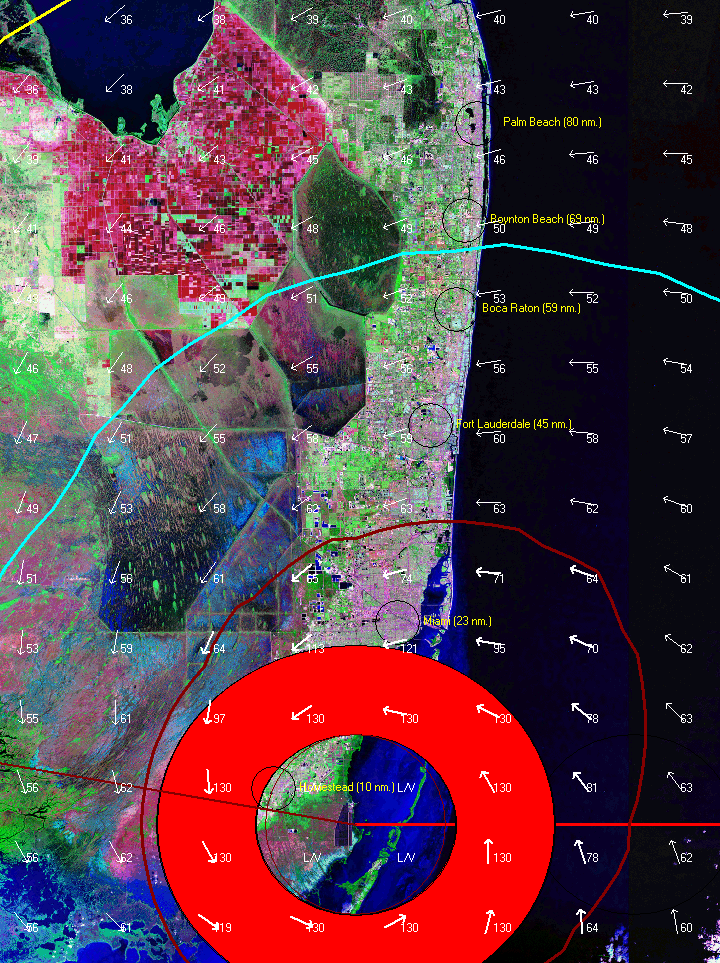
The user has the option of displaying the storm tracking information on LandSat images. This provides a great visual method of determining the land type areas being impacted by a storm.
The example below shows a LandSat of the SE Coast of Florida with Hurricane Andrew's wind field superimposed on top. Notice the distinct difference between the urban areas on the coast and the inland crop (sugar cane) and everglades areas.
The following is an image of Hurricane Isabel as it approached the North Carolina coastline. Note how the inland areas most impacted are characterized by crop land (red tint). The urban area of Norfolk, Virginia Beach can be seen at the top of the map (purple/gray tint).