Hurricane Forecast Model Data

One of the tools that the forecasters at the National Hurricane Center use are the numerical forecast models.  They include models such as the GFDL, UKMET, NOGAPS, AVIATION, ECMWF, LBAR, BAMM, BAMD and NHC90/98.  The HURRTRAK system now allows the user to display selected forecast model data on a tracking chart. 

The screen below is an example of the various forecast for Hurricane Floyd while off the Southeast United States coast.. (the model plots in this example are not based on actual data).


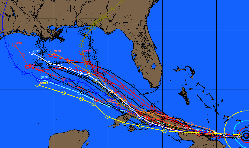
The forecast model data can be manually entered into the system or with the HURRTRAK ONLINE service, the data is automatically downloaded into the system..

It is important to note that the user should always make plans based on the official NHC forecast and not on forecast model "raw" output.