Forecast Precipitation
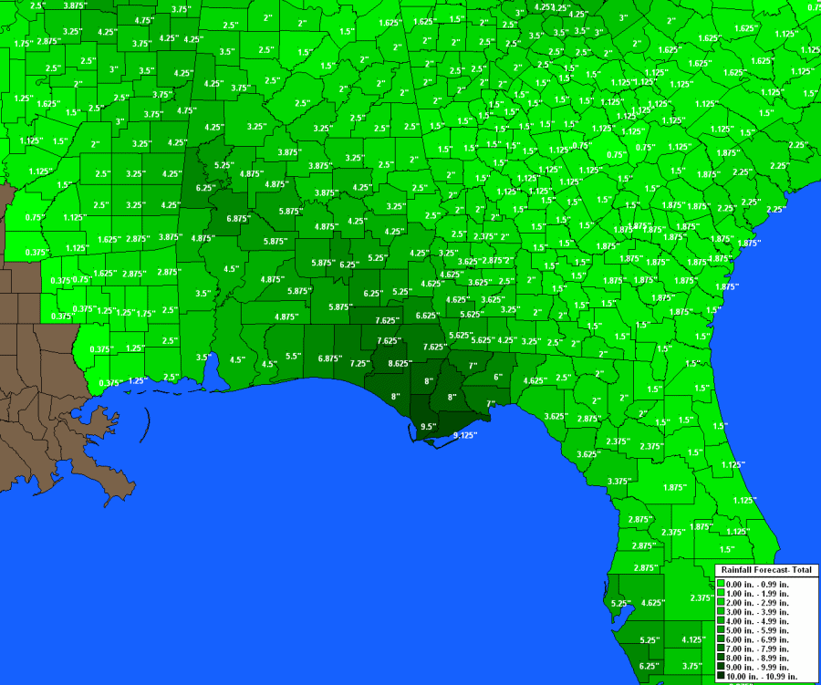
Heavy rain and it's associated flooding is a major threat from landfalling tropical systems. With the Hurrtrak system the user can display the National Weather Services 72 hour precipitation forecast on any tracking chart or county thematic map.
If the analysis option is selected, rain total isopleths are drawn indicating the areas and amounts of precipitation expected.
If the County Thematic option is selected, the system will represent
the data on a pan and zoom type county thematic map.