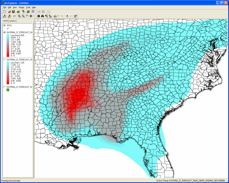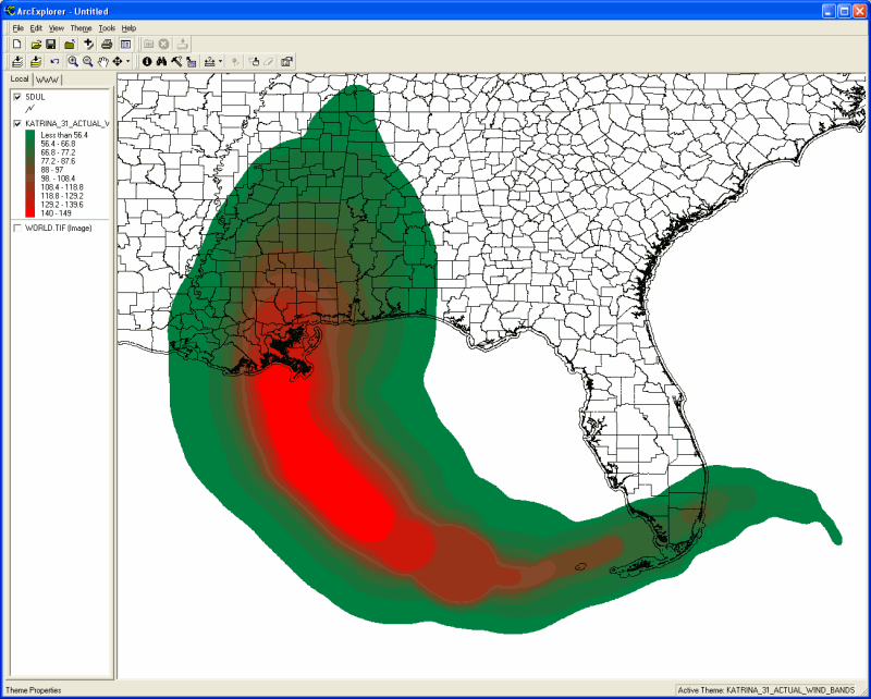
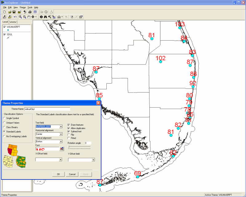
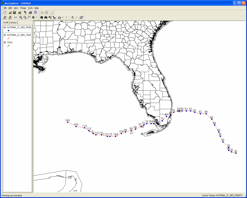
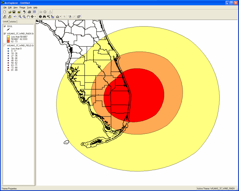
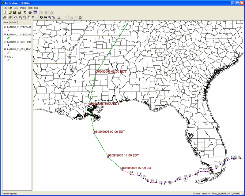
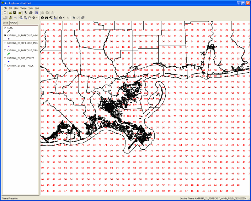
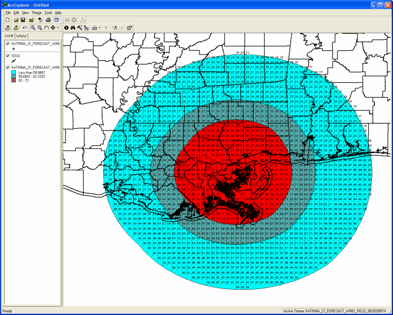
The HURRTRAK Advanced system has the ability to export several types of system outputs to an ESRI type shape file (supports point, polyline and polygon type files). The following shows the different types of data can be exported to a Shape file as well as an example of each using ArcExplorer (free application).
In 2007, we added Average Forecast Error, Forecast model tracks, Climatic forecast and Watches and Warnings to the list of items than can be exported to shape files.
- Actual and Forecast Wind
Bands
- Location Impact Summary
Report data
- Current Storm Tracks and Observations
- Current Wind Field Grid
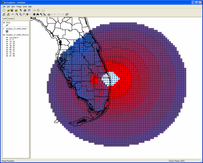
- Current Wind Radii
- Official forecast track
and forecast points
- Official Forecast Wind
Field Grid (0- 120 hours)
- Official Forecast Wind
Radii (0-120 hours)
- Rainfall Forecast for
next 3 days