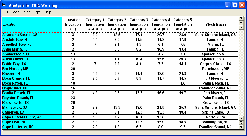
The HURRTRAK system can generate a SLOSH inundation report for any location group. The system determines the closest SLOSH basin to each location and uses it to analyze the maximum flooding potential. The report below shows locations in a NHC Warning group. Notice how each location may use a different SLOSH basin.

![]()
Copyright ©2005 PC Weather Products, Inc., All
Rights Reserved.