
Subscription service, 2026
StormInfo
Atlantic storm information on the web and by email. No software to install.
$1,755.00 per year $400.00 per year for current HURRTRAK customers
StormInfo brings you the latest information on every Atlantic tropical storm through a members-only website, by email and on X (Twitter). Each storm gets its own page of tracking charts, wind and rainfall maps, National Hurricane Center bulletins and impact reports.
All you need is a web browser and an email program. Customers of our HURRTRAK software or HURRTRAK Online can add StormInfo at a reduced price.
What you get
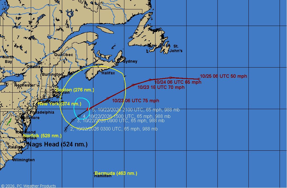
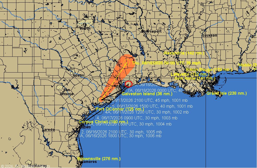
- Large and small scale tracking charts for each storm
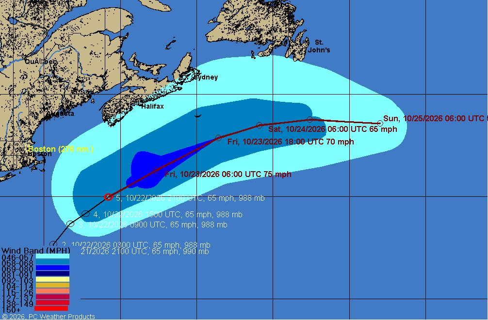
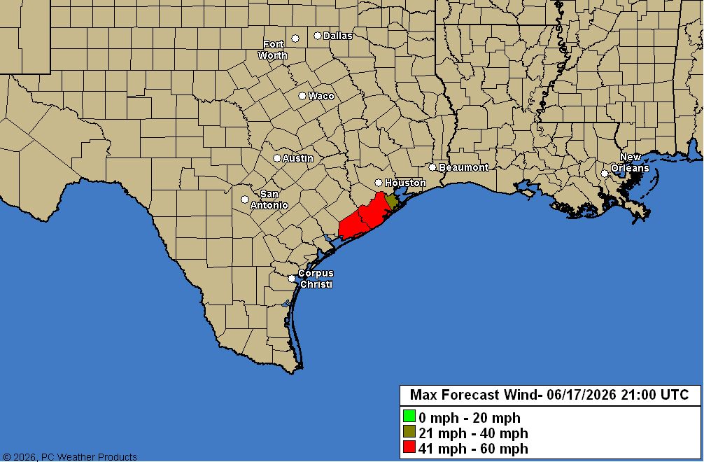
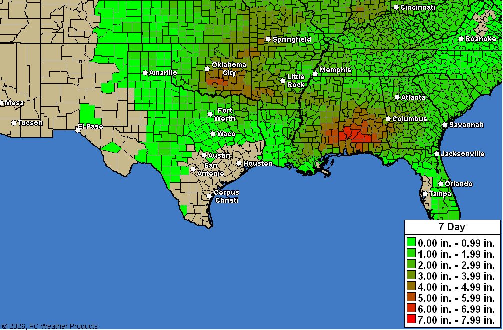
- Forecast wind bands, strike probabilities, and county wind and rainfall forecasts
- NHC advisories, forecast discussions and wind speed probabilities
- Observation and location impact reports
- A personal impact report for your own location, emailed with every NHC update
- Instant updates on X (Twitter)
- Expert analysis from our meteorologists, including the daily ExpertEase video
- Personal storm surge maps for a location you choose
Storm graphics
Every storm page includes maps like these, shown here from the 2026 season, along with a strike probability map, a 72-hour forecast animation and links to the latest satellite images. Select a map to see it full size.
Bulletins, reports and updates
- NHC public advisory
- The storm's location, strength and expected motion, with any watches and warnings.
- NHC forecast advisory
- Forecast positions, maximum winds and the extent of damaging winds.
- NHC forecast discussion
- The forecaster's reasoning behind the latest forecast.
- NHC wind speed probabilities
- The chance of tropical storm and hurricane force winds at specific locations.
- Observation report
- The latest observed details of the storm.
- Location impact report
- A summary of the storm's expected impact on a list of locations.
- Personal impact report
- Forecast wind impact for your own location: peak winds and when they arrive, closest approach, expected damage, strike probability, and when damaging winds start and end. Emailed right after each NHC update. One location is included; more are available at a small extra charge.
- Updates on X (Twitter)
- Instant updates as storms develop and change.
Expert analysis
Our meteorologists add a daily video and a written discussion covering overall tropical activity and a detailed look at every disturbance, depression, storm and hurricane. When a storm threatens land, the discussion is updated through the day as the situation changes.
The daily video is ExpertEase, our chief meteorologist's briefing on the tropics, the same one built into HURRTRAK.
Personal storm surge maps
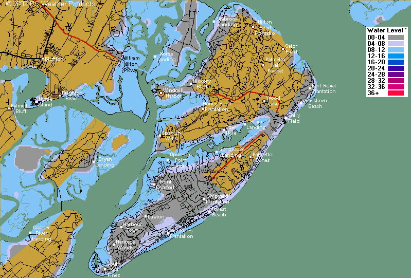
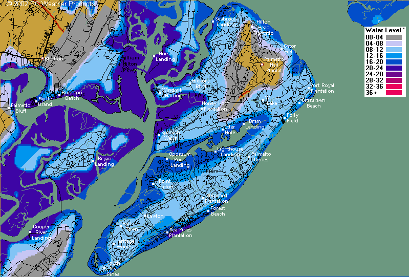
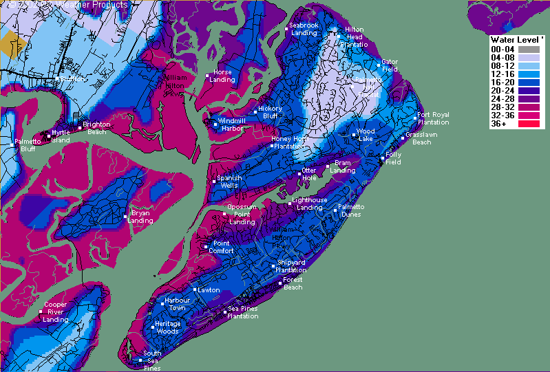
Your subscription includes a set of detailed maps for an area you choose, one for each hurricane category from 1 to 5, showing the highest flooding storm surge could bring. You set the map's location and scale, and we email you the images.
The maps aren't tied to a particular storm. Each one shows the worst case for its category. Maps for more locations are available at an extra charge.
The examples below are for Hilton Head Island, SC. Colors show the potential water level in feet.
How to subscribe
-
Ask for a quote
Call 800 605-2230 or 770 953-3506, or email pcwpsales@pcwp.com.
-
Pay your quote
Pay through the secure link in your quote, or send a check or purchase order. See how to order.
-
Log in
We'll send you a user ID and password for the members site. From there you can set up your location and request your storm surge maps.
Subscribe to StormInfo
Call 800 605-2230 or email pcwpsales@pcwp.com for a quote. Subscribers can log in at storminfo.us.