Change History for HURRTRAK RM/Pro & HURRTRAK Global RM/Pro (does not include 2014 changes and 2015 changes and 2016 changes)
Version 2013 Changes
Expert Ease" – Our highly rated ExpertEase, was introduced last year and will continue in the 2013 software. Please note that this feature is ONLY available to users who maintain the current version of the Hurrtrak software. In order to continue receiving these updates, you need to upgrade to the 2013 software. For those less familiar with this feature, ExpertEase provides another tool in your data arsenal. On a daily basis, our chief meteorologist will discuss via video update, current tropical conditions as well as what is likely to occur in the near term. His observations are integrated within the Hurrtrak program throughout the Atlantic Hurricane season. Unique to PC Weather Products portfolio, ExpertEase gives you “inside” knowledge of the factors and conditions affecting the path and strength of active tropical storms and/or the tropical season in general. Remember, it is available to all users with current Hurrtrak software installed.
Desktop Rebuild – This change represents a major enhancement to the user “experience” in 2013. The Hurrtrak system will now “remember” the graphics, reports and animations created/viewed for a storm, and recreate them automatically when reloading or when storm data is updated. This will routinely and significantly reduce time (and key/mouse strokes) spent re-creating graphics and reports that you typically generate for a storm. Items automatically rebuilt include ALL of the tracking charts and the options displayed on them. Other items rebuilt include:
• Wind Band Analysis
• Location Impact Reports
• Animations
• County and ZIP Based Impact Reports
• Wind Probability Analysis
• Wind Probability Reports
• Surge Probability Analysis
• Rainfall Analysis and Thematic ChartsEnhanced Hurricane/Tropical Storm Watches and Warnings - The system is now able to determine whether individual locations are included within NHC/NWS issued hurricane and tropical storm watches and warnings. This is displayed graphically and also included on all location based reports. These include the EZ-report, Location Wind Profile, County Wind Profile, Zip Code Wind Profile, Executive and Risk-Impact reports.
Enhanced Wind Radii Estimation for Joint Typhoon Warning Center storm forecast - We have significantly enhanced the wind radii estimation for the "missing data" problem for storms in the Western Pacific and Indian Ocean. This will now allow Global and Hurrtrak Advanced users to create consistent animations, wind band charts and most importantly allow for impact reporting for both land and sea locations.
Excel export enhancements – Excel export now includes location watch/warning information.
Tray Alert Message – The "tray alert" will now alert users when their "base" location has tropical storm or hurricane warnings / watches issued for it.
Google Earth export enhancements – Google Earth export now includes watch/warning information.
Tab and Automatic Summary Report Enhancements – Automatic Location Impact and Executive reports now include watch and warning information for the location(s) being analyzed.
Narrative Impact Description - The narrative now includes comments on whether the analyzed location is “under” a tropical storm and/or hurricane watch or warning.
SLOSH/Storm Surge improvements – Six more SLOSH basins have been updated and rolled into the 2013 release. This includes the following basins... Corpus Christi, Norfolk, Pamlico Sound, Apalachicola, Penobscot Bay and New Orleans. Much more detail along with software improvements have made the Storm Surge program easier to use.

Version 2012 Changes"Expert Ease" – We are particularly excited about this one! With Expert Ease you have another tool in your data arsenal. On a daily basis, our chief meteorologist will discuss, via video update, current tropical conditions as well as what is likely to occur in the near term. His observations are integrated within the Hurrtrak program throughout the Atlantic Hurricane season. Expert Ease gives you "inside" knowledge of the factors and conditions affecting the path and strength of active tropical storms and/or the tropical season in general. It is available to all users with current Hurrtrak software. (Click on the image to the right for more information.)
EZ Map – Enables both new and seasoned users to be more productive immediately. Press a button, and the system generates a tracking map for a current storm with all of the most common plot options. Choose anything from a default to user specific options.
EZ Report – Designed for new users, but useful for everyone. Simply supply a valid US address (street address, city-state, zip code) and the system generates an informative report for that single location. No need to add the location into the systems database or associate it to a location group. Just click on the "EZ" button, supply an address and you have your report…Boom!
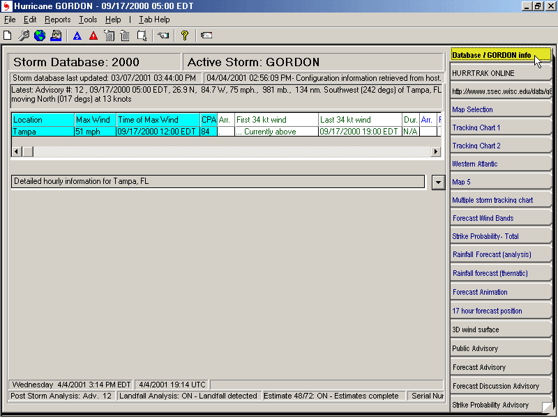
Storm Conditions Display - The system now has an enhanced opening display (main tab) that via text and graphics, shows the current storm’s conditions including its strength, position, central pressure, motion and category of the storm.
Hurricane Model enhancement - Our model display program has been enhanced in several ways, focusing on efficiency and ease of use. You can now mouse over a forecast line/point and information about that model automatically displays the model name and description with details about the forecast point including forecast intensity. Additionally, users can select models they would like to see directly from the model display program and/or select "Max's favorite models"... which is a list of the hurricane models that Max Mayfield follows.
Automatic Summary Report Enhancements - The Automatic Summary reports now optionally include the storms forecasted wind bands.
Narrative Impact Description – Comments on the likelihood of the analyzed location being impacted by the eye/eye wall and maximum storm surge of the storm are now included.
Usability enhancements - Made several changes including the ability to control the width of the forecast and model plot lines.
Expanded County Reports - We’ve added a new location group (US Counties) which covers all US counties. Users will now be able to create county based Risk Impact Analysis and Executive reports.
Location Import Improvements – The location import utility has been modified to make it more flexible in accepting different comma delimited formats (Hurrtrak Advanced).
SLOSH/Storm Surge improvements – New Orleans, Lafayette, Galveston, Jacksonville, Savannah and Charleston basin analysis updates have been rolled into the 2012 release. Much more detail along with software improvements have made the Storm Surge program easier to use.
Improved Email address book maintenance – Bulk addition and deletion of email addresses is now available making email address management a snap!
EXCEL Export – Excel export of location forecast impact is now standardized. Columns are now the same between forecast and actual reports and some fields have been standardized to always have numeric data. This should make it much easier for users to export the Hurrtrak data to another format or separate program.
Version 2011 Changes
– For 2011 we’re launching a tool that gives users the option to selectively turn on and turn off data layers during a tracking exercise. For example, rather than plotting a storm or geographic feature and then having to “undo” it at a later time... the user may now simply select/turn on an icon to show the information on a tracking map and select the icon again (turn off) to remove it from the tracking map. This real time enhancement makes creating a tracking map display extremely quick and easy
New Maps – Several new topographical/relief type maps have been added this year. You may now display the storm on an attractive map background which indicates mountainous areas, low lying areas, etc..
Simplified Google Earth Selection & Output – For 2011, we’ve made interfacing with Google Earth a “breeze”. With just ONE click, you can create a collection of Google Earth output and bundle them into ONE file. AND, you can either save it as a file, save it to the EMail Outbox for later EMailing, Email it immediately or initiate a Google Earth session. In addition, Google Earth files can now be automatically generated and Emailed when new data arrives on a current storm (see more below).
Revamped Automatic Summary Report - The definition of Automatic Summary Reports is significantly streamlined and more intuitive in this years’ software. A fully renovated user interface enables you to define the summary report on one screen with interactive feedback as you enter/modify the report’s parameters. We have also added a new automatic report... Risk/Impact Summary Report.
Redesigned EMail Alerts - We love all of our improvements, but believe that this 2011 enhancement will really make you stand out with those you support…a genuine WOW factor!!! Similar to the Automatic Summary Reports, we completely reworked the EMail Alert function. The result has been a much more intuitive interface that supports more flexibility when defining the “Alerts”. In addition to identifying which users will receive an alert, you can also indicate which storms to include (or exclude) as well what schedule is best for each alert. ***We have also created a NEW ALERT which will notify a user whenever one (or more) of their locations is expected to be impacted by a storm.*** These features really need to be experienced to be fully appreciated!
New Automation Capabilities – When redesigning the Automation Summary Reports and EMail Alerts, we added a new category of automation. It allows the user to quickly create and optionally email the following output... Google Earth interface files (KML), EXCEL Location Impact reports, Shape Files (Hurrtrak Advanced users) and plotted storm tracking maps. It also has an intuitive/easy to use interface.
Improved Past Forecast Selection - The selection of “prior” forecast tracks has become much easier by allowing the user to quickly select/deselect earlier advisories forecast. This allows you to quickly determine how the anticipated track may change with each new forecast.
Improvements in Tropical Weather Outlooks – Global users will appreciate the addition of the JTWC graphical outlook images in 2011.
SLOSH/Storm Surge improvements – New York, Wilmington/Myrtle Beach, Florida Bay, Fort Myers, New Orleans, and Laguna Madre basin analysis updates have been rolled into the 2011 release. Much more detail along with software improvements have made the Storm Surge program easier to use.
Expanded Watches and Warnings – We will support the new areas of watches and warnings being utilized in 2011 which includes Puerto Rico and the US Virgin Islands.
Enhanced Location Database – The addition of a new WORLD location group makes it much easier to plot and analyze storm impact worldwide.
Additional CommandBar "Themes" - New command bar color "themes" have been added allowing you to personalize the look and feel of the system even more than in the past.
Version 2010 changes
- – A 2010 “facelift” provides greater use of command and toolbars as well as ease in selection of maps and satellite images. This makes the system considerably easier to use and allows you to get the job done quicker.
- – For anyone who emails information from the Hurrtrak system.. and who doesn't... this is a welcome time saving addition which allows the user to send multiple application outputs in a single email. Simply select the graphics or reports you wish to email and hit “Send.” There is no limit to the number of attachments you can include.
- – Just “point & click” on a tracking map and display forecast wind speeds for desired location. A great way to see how wind forecasts vary from location to location, particularly when using Advanced Wind Estimation.
- - You asked and we delivered! We now have a much easier, highly interactive method to pick and choose those forecast models you want displayed within the Hurrtrak system.
- - New "tab" displays the Risk/Impact information, along with a wind speed/ direction graph for base locations. PLUS…you now have the ability to define more than one "base" location to quickly assess the forecasted impacts to ALL of your high priority sites/locations.
- – New forecast report combines risk analysis and wind forecast data in one graphically attractive report. Report includes risk analysis color bars as well as a chart of the location's expected wind speeds and wind directions during the passage of a storm.
- - This is now part of our standard report set. It is directly selectable from the reports menu making it a simple “one click” option.
- – Personalize your system's look and feel by using different application color and font schemes or "skins" with the Hurrtrak Application. Folks who want larger fonts will love this! Choose from several included “skins” or import your own.
- – Our software now displays counties, major roadways and state border outlines as "layers" on any tracking map. State borders are particularly useful on tracking maps that also display counties and all thematic type maps.
-
- – EMail Alerts can now include the Narrative Impact Statement within the body of the Alert Email. This provides recipient(s) with not only the fact that the Alert Condition has been met but with the expected impact to the Alert Location…in a narrative format.
- – Users who must take actions based on wind speeds AND time frames will love this! Our new EMail alert condition allows you to define an Alert which in turn notifies recipients that a certain wind speed is forecast to impact the Alert Location WITHIN a specific number of hours. (For example: “Alert me when 50 MPH winds are forecast for a location within 48 hours.”)
-
-
Enhanced Google Earth exports
– 2010 includes
several more Google Earth exports including SLOSH
Storm Surge Reports.
- Expanded Hurricane History Database
- Updated Watch and Warning breakpoints
- Updated Average Forecast Error data
- Update Tide database
Version 2009 changes
Expanded Google Earth Information –
Version 2008 changes
Native Google Earth Interface – this allows the user the ability to export lines, points and polygons to GE via it’s native KML language. In 2008 there are additional Google Earth export types including wind arrows, and summary report detail.
Enhanced Google Earth exports – In 2008 we are adding several more exports such as: the ability to add images to location impact reports; detailed hourly summary information; display of wind field arrows, and much more
Estimation of 25 knot wind radii – This enhancement allows the system to estimate wind speeds below 34 knots (from 25 knots - 34 knots). This is reflected on the system graphics and reports.
Graphical Tropical Weather Outlook - Support for this new product being issued by the TPC.
Desktop Satellite Animation
High Resolution Recon Reports – You can now display the high resolution reports coming in from the Hurricane Hunter aircraft.
Improved Summary Reports
Version 2007
changes
-
Native Google Earth Interface – this allows the user the ability to export lines, points and polygons to GE via it’s native KML language. This is a major enhancement to the system and the result is an impressive array of visualization capabilities.
-
Animated Wind Pattern graphic - We have taken the animated wind pattern capability that was introduced last year and improved it by allowing the user to view an animated wind pattern.. with or without Advanced Wind Estimation.
-
NHC Wind Probabilities – This year we will support the “new” NHC wind probabilities. This support is evident in several areas of the system
-
Enhanced SLOSH Inundation Analysis – We have increased the resolution of our elevation database, used for inundation analysis, from 90 meters to 30 meters… a 9X increase in detail. The result is a much more detailed and accurate SLOSH inundation analysis.
-
Additional detailed SLOSH data – In addition to updating our SLOSH database with the latest changes from NOAA
-
Desktop Satellite Enhancements – You can now specify up to 3 daytime and 3 nighttime satellite images.
-
Enhanced E-mail Alert – As mentioned earlier, we have added wind probabilities as e-mail alert criteria. For example you can specify that you want an alert email sent when forecast wind probabilities for a location will exceed specified values for 34, 50 and/or 64 knot winds.
-
Daylight Savings Time changes – We have changed the system to accommodate the new DST rules.
-
Point and click reports – While viewing a tracking chart, you can now simply right-click on a map position and generate an impact report location.
-
Improved Summary Reports - Now includes Wind Probability data.
-
Updated street database – We have updated the street level database to the most current available.
- Expanded Hurricane History Database.. now from 1851 to 2006.. this contains best track information
- Updated Watch and Warning breakpoints
- Updated Average Forecast Error data
- Update Tide database
- Enhanced system and user preferences (options)
- Miscellaneous User Interface improvements
Version 2006
changes
-
Google Earth
Interface -
this allows the user to display most of the HURRTRAK
graphics "on top" of a Google Earth "earth" image. Google Earth is a free
application available at
http://earth.google.com/ .
- New Wind Pattern Display
- this graphic shows the wind field around a storm in a solid color coded manner.- Multi-Colored Wind Vectors
- Optional method of viewing the wind field around a storm... either in static or animation mode- Enhanced forecast wind estimation/Eye Diameter control
- Wind estimation has been improved by allowing for forecast period eye diameter considerations. Users can define a default eye size as well as a transition period for a current storm to change from a very small or large eye to a "normal" one. - Non Location based Summary reports - Users can now define automatic summary reports without defining a location. This expands the definition of summary reports to include both location-storm reports and simply storm based reports.
- Customizable Summary Reports - In addition to the item above, automatic summary reports can now be customized to include or exclude different sections of the report.
- Chart note display improvements - Chart notes can now be displayed manually by "grabbing" an observation point and using the mouse drag and drop feature. This has also been extended to the Main Informational database tab in order to allow the user to select observations for Post Storm Analysis.
- Wind band export enhancements - data smoothing has been introduced to produce a more realistic wind band pattern.
- Outlook Email Improvements - User has ability to save email in the Outlook drafts folder instead of an immediate send from the HURRTRAK system. This allows the user to open the email in Outlook, include additional attachments, etc. before sending.
- Radar - National mosaic radar image can now be used as a background tracking map.
- Hurricane History - Color coded tracks as well as a thin or thick line option.
- QuickPlot enhancements
- Enhanced Location Maintenance - Ability to add locations graphically.. via map point selection.
- Quiet Updates - ability to have HURRTRAK ONLINE update the system databases without displaying status window.
- Expanded Hurricane History Database.. now from 1851 to 2005.. this contains best track information
- Updated Watch and Warning breakpoints and Tide databases
- Enhanced system and user preferences (options)
Version 2005 changes
Version 2004 changes
-
Microsoft Outlook Email Interface – this function allows the user to utilize
their MS Outlook address books and send capabilities from within Hurrtrak.
This eliminates the need to maintain email list on both Outlook and Hurrtrak
and also saves (optional) all emails sent from Hurrtrak.
- Enhanced Advanced Location wind estimation – this function introduces in 2003 is being greatly enhanced by the introduction of the NLCS (land usage) database. This allows the system to automatically determine the surface roughness (friction) of the location being analyzed without the user having to define any of these parameters
- New Zip Code Wind Thematic Chart. Similar to the County based wind thematic except at a much more detailed level of zip code.
- Animated Gifs – this will allow the user to save and send any storm animation sequence
- PDF Support allows the user to save and send all reports and graphics in PDF format. This addresses any formatting inconsistencies when sharing reports and also addresses security problems when sending HTML reports.
- New LANDSAT based tracking maps. This allows the user to better visualize the characteristics of the land areas being impacted by a storm.
- New Topographical tracking maps. Two new tracking maps allow the user to see the topography that may impact a storm’s strength.
- New H*WIND Display program that displays detailed “estimated” storm winds provided by the NOAA’s Atlantic Oceanographic and Meteorological Lab. . This data is provided by AOML on a “best can do basis”.
- Point and Click Impact Reports. This allows the user to graphically select the forecast wind impact location.
- Enhanced Wind Band Analysis to show 10 levels of wind
- Color Coded storm tracks
- Enhanced system and user preferences (options) interface
- Expanded Hurricane History Database. Now from 1851 to 2003
- Updated Tide, County and Zip Code database
Version 2003
changes
- Support of National Hurricane Center's new 96 and 120 hour forecast (integrated into all functions)
- Advanced Location Wind Estimation - This function takes into consideration local "site" factors such as local exposures, varying vegetation types as well as the density of man made structures to compute a more accurate wind speed estimate
Version 2002
changes
Version 2001
changes (2001)- New tab based user interface that allows the user to easily select and view system tracking charts, graphics and reports
- New risk alert feature that allows the user to quickly and easily determine a location's risk from the current storm
- Enhanced Email Alerts... allows user to send a tracking chart as an attachment
- Automatic plotting of tracking charts. When a storm is opened or updated, the storm’s actual and forecast track can be automatically plotted
- Automatic creation of reports. When a storm is opened or updated, the "favorite" reports are automatically created.
- Enhanced mapping capabilities, which allow both variable (pan and zoom based) tracking charts and “favorite” fixed style tracking charts
- Integrated Web Browser. One of the “tabs” is an Internet Explorer window which can be used to show your favorite satellite image from within the HURRTRAK system
- Simplified the definition of Alerts and Summary reports.
- Updated Slosh database. Now includes Atlantic City and Ocean City basins.
- Enhanced Alert Capabilities
- Updated Tide, County and Zip Code database
- Integrated HURRTRAK ONLINE. Now the retrieval of HURRTRAK ONLINE information is fully integrated with the HURRTRAK module
- Enhanced Print Preview capabilities
- Enhanced Toobars and popup menus
- Updated Tide database
Version 2000
changes (2000)- New Pan and Zoom mapping capabilities which allows the user to select any size and scale map
Version 3.0 changes (1999)
- New 32 bit version specifically designed for WIN 95/98, WIN NT
- Ability to send an image, text and advisory attachments
- Ability to send reports such as the summary and detailed impact reports
- Ability to automatically send email notices when certain "base location" conditions are met. These conditions can be varied by email recipient.
- Ability to setup the system to automatically send graphic and text information when new data arrives
In case you missed Version 2.0 (1998)
- Added very detailed tracking/SLOSH charts
- Added the ability to customize tracking chart color scheme
- Added automation capabilities
- Added summary reporting
- Added the Slosh model (MOM) storm surge data
- Added a forecast and actual Coastal Flood index capability
- Added a forecast and actual location coastal flooding analysis feature
- Added forecast and actual zip code coastal flooding analysis feature
- Added onshore wind component added to detail location report
- Added graphical based custom map creation
- Added Latitude / Longitude grid
- Included the ability to save a fax image
- Now Year 2000 compliant
- Added a User Diary
- Included Font control for all text
- Added Wind band and flood index legends
- Added ability to copy storm to current database
- Added "Quick TAU" function
Version 1.0 of the HURRTRAK RM/Pro (1997) had all of the capabilities of HURRTRAK EM/PRO V2.0 plus the additional capabilities of
- Ability to create a forecast impact analysis by zip code
- Ability to create an actual impact report for location, zip code or county
- Ability to create a detailed zip code analysis report
- Ability to add up to 10 custom zip code or county data fields for reporting summaries
- Ability to overlay past storm tracks on the same chart as a current storm
- Ability to do extensive historical analysis
![]()
Copyright ©2004 PC Weather Products, Inc., All
Rights Reserved.